
2D Wave Spectral Data, South Arm, Great Salt Lake, Utah
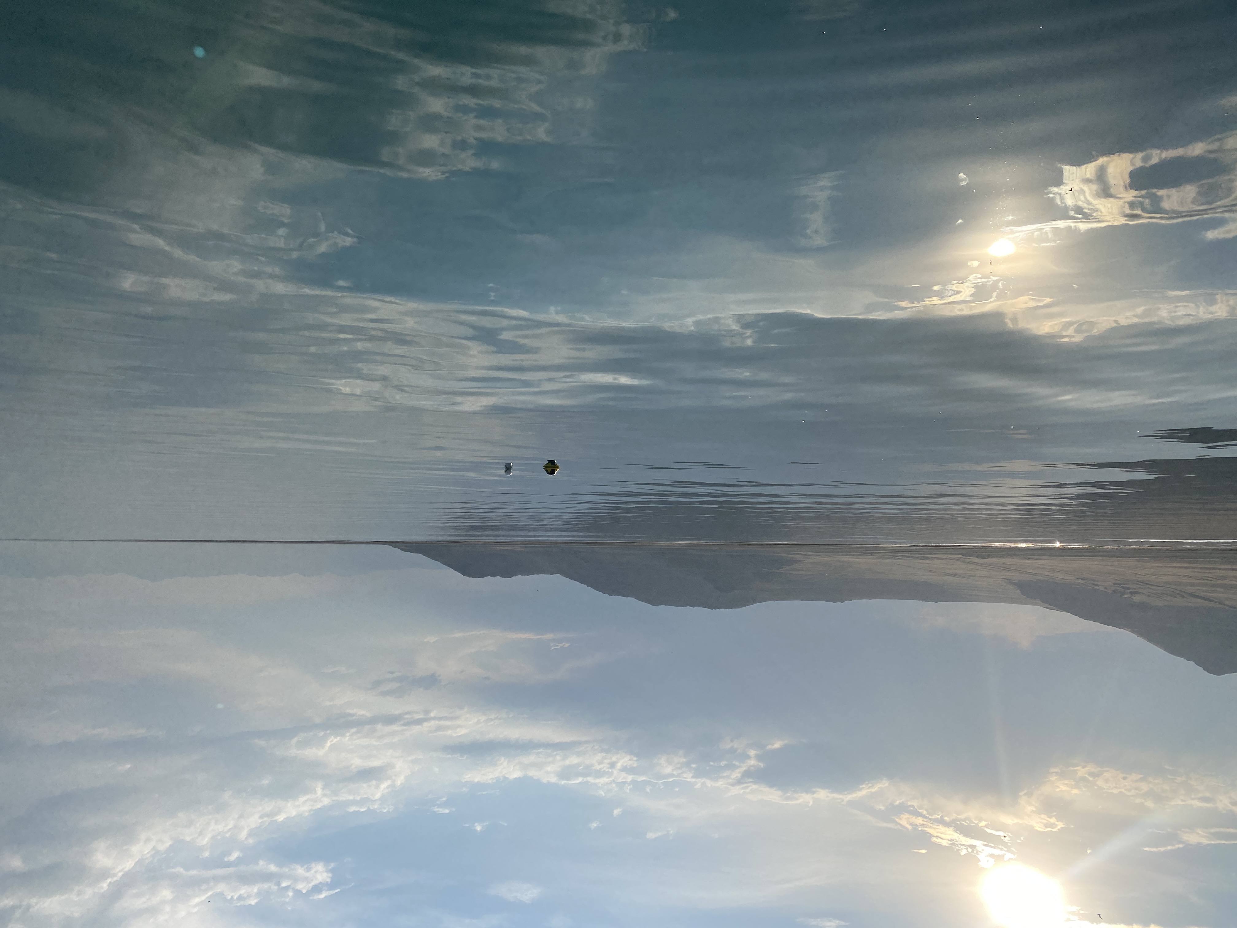
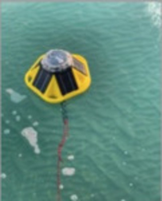
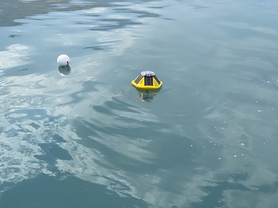
Data are produced by two SoFarOcean Spotter wave buoys deployed at two locations along the south arm of the Great Salt Lake from the period of July 13, 2021 through June 28, 2022. The two sites were selected based on public interest and scientific importance. Buoy 1356 (Blackrock Point) was deployed near Great Salt Lake State Park and buoy 1328 (Miera) was deployed near Antelope Island State Park. Both buoys were deployed in relatively shallow water, approximately 2.5m for #1356 and 1.6m #1328.
The buoys were set to transmit in real time through using Iridium satellite networking capabilities. Buoys operated in six-hour cycles, alternating 5 hours of rest with one hour of active data collection. At the end of each cycle, buoys performed onboard processing of accelerometer data, converting it to spectral wave parameters—e.g., significant wave height, peak and mean direction, and spectral moments using open source algorithms made available by SoFarOcean. At the end of the study, higher-frequency data were retrieved from the buoy’s onboard memory and processed using SoFarOcean parsing and analysis scripts (parser_v1.12.0 included in each subfolder). This repository provides the full dataset from the buoys’ onboard memory card, the parser script version used, and the resultant output derived data. For complete information on the specific parameter and output files, see the parsing script included within the dataset subfolders.
-

SPOT1328 Meira Spit
Robert C. Mahon, Elizabeth J. Trower, Benjamin P. Smith, Tyler A. Lincoln, Juliana Olsen-Valdez, John S. Magyar, and Cedric J. Hagen
Data in this folder are produced by a SoFarOcean Spotter wave buoy deployed along the south arm of the Great Salt Lake, near Antelope Island State Park from the period of July 13, 2021 through June 28, 2022, in relatively shallow water, approximately 1.6m.
IMPORTANT NOTE: Water depths for #1328 (Miera Spit) started at ~1.7 m, but dropped rapidly to 0.9 m on July 15, 2021 and dropped further to ~0.4 m on August 17, 2021. The timing of these rapid water depth changes matches the timing of buoy location changes when the anchor was dragged inshore by waves. When buoy #1328 (Miera Spit) was retrieved at the end of the study period, it was partially beached with its ballast chain touching the bed. We surmised that data quality was suspect after the second abrupt change in water depth on August 17th, 2021 when the anchor was moved.
-

SPOT1328 Meira Spit Derived Data
Robert C. Mahon, Elizabeth J. Trower, Benjamin P. Smith, Tyler A. Lincoln, Juliana Olsen-Valdez, John S. Magyar, and Cedric J. Hagen
Data in this folder are produced by a SoFarOcean Spotter wave buoy deployed along the south arm of the Great Salt Lake, near Antelope Island State Park from the period of July 13, 2021 through June 28, 2022, in relatively shallow water, approximately 1.6m.
IMPORTANT NOTE: Water depths for #1328 (Miera Spit) started at ~1.7 m, but dropped rapidly to 0.9 m on July 15, 2021 and dropped further to ~0.4 m on August 17, 2021. The timing of these rapid water depth changes matches the timing of buoy location changes when the anchor was dragged inshore by waves. When buoy #1328 (Miera Spit) was retrieved at the end of the study period, it was partially beached with its ballast chain touching the bed. We surmised that data quality was suspect after the second abrupt change in water depth on August 17th, 2021 when the anchor was moved.
-

SPOT1356 Black Rock
Robert C. Mahon, Elizabeth J. Trower, Benjamin P. Smith, Tyler A. Lincoln, Juliana Olsen-Valdez, John S. Magyar, and Cedric J. Hagen
Data in this folder are produced by a SoFarOcean Spotter wave buoy deployed along the south arm of the Great Salt Lake, near Antelope Island State Park from the period of July 13, 2021 through June 28, 2022, in relatively shallow water, approximately 1.6m.
-

SPOT1356 Black Rock Derived Data
Robert C. Mahon, Elizabeth J. Trower, Benjamin P. Smith, Tyler A. Lincoln, Juliana Olsen-Valdez, John S. Magyar, and Cedric J. Hagen
Data in this folder are produced by a SoFarOcean Spotter wave buoy deployed along the south arm of the Great Salt Lake, near Antelope Island State Park from the period of July 13, 2021 through June 28, 2022, in relatively shallow water, approximately 1.6m.